目标
获取一个最简单的OSM文件,并学习其最基础的结构。
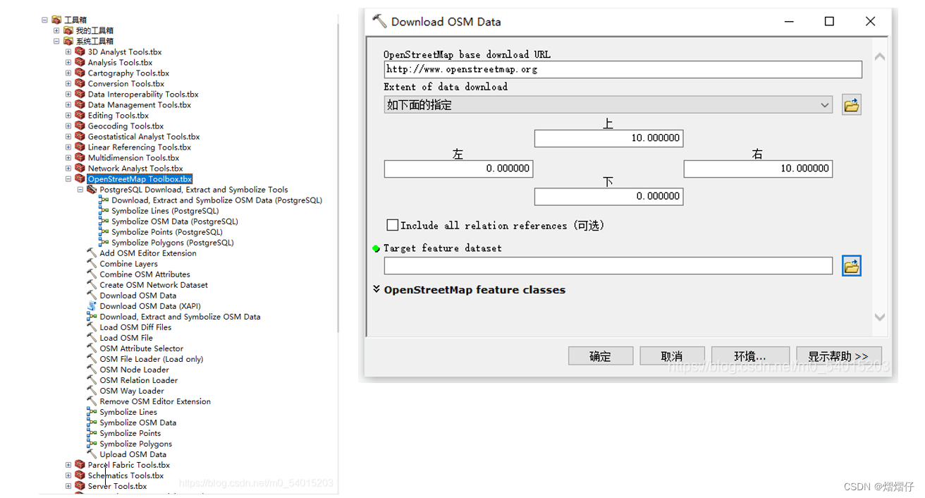
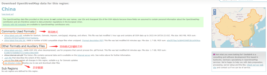
获取OSM数据的步骤
操作很简单:
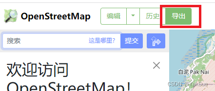
进入官网:https://www.openstreetmap.org/
点击左上角的 “导出” 按钮。
然后,填入坐标范围,点击按钮即可导出osm文件:
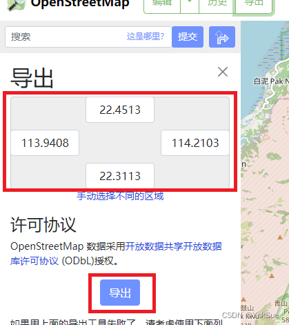
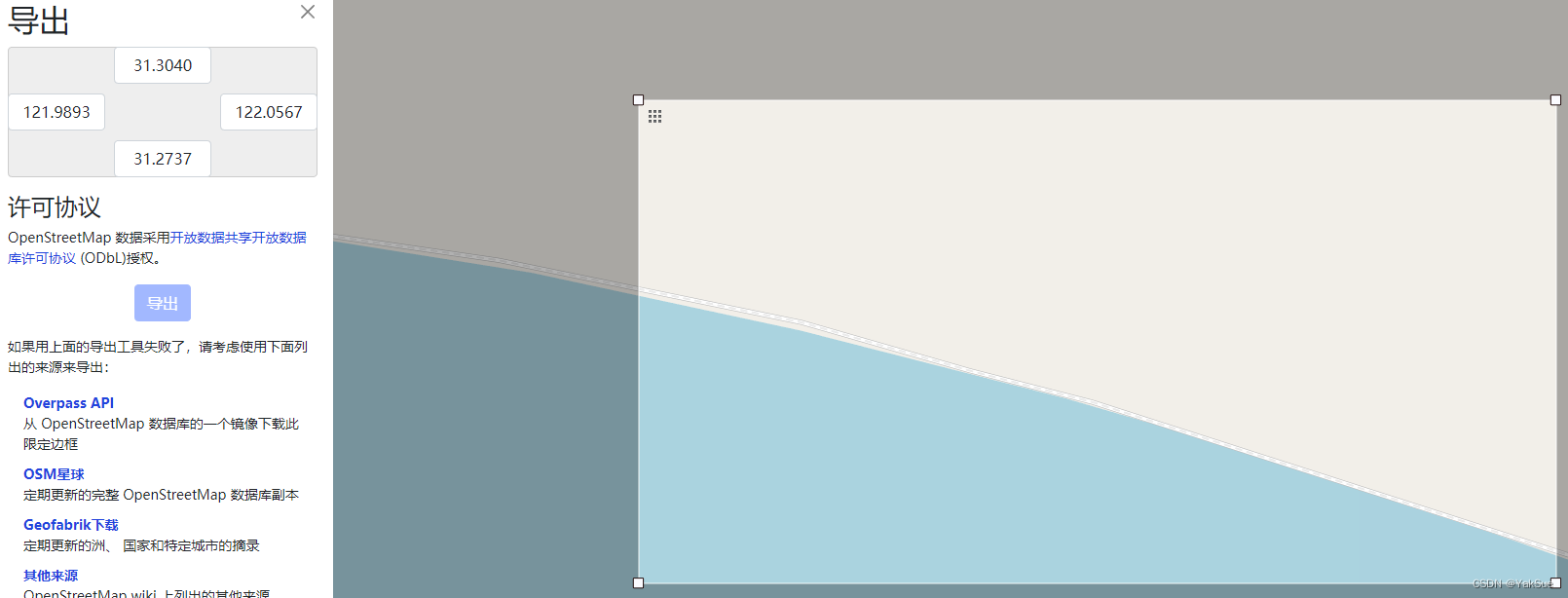
当然,直接填坐标范围是不直观的,为此,可以点击 “手动选择不同的区域”,这样即可手动选择范围了:

学习OSM文件格式的最基础结构
Wiki上有关于OSM格式的简单介绍,可见附录。不过这里将通过例子来学习:
例1:最简单的例子
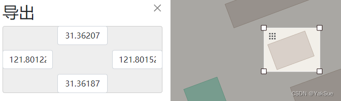
导出后的osm文件内容如下:
<?xml version="1.0" encoding="UTF-8"?>
<osm version="0.6" generator="CGImap 0.8.8 (2798843 spike-07.openstreetmap.org)" copyright="OpenStreetMap and contributors" attribution="http://www.openstreetmap.org/copyright" license="http://opendatacommons.org/licenses/odbl/1-0/"><bounds minlat="31.3618700" minlon="121.8012200" maxlat="31.3620700" maxlon="121.8015200"/><node id="7603536329" visible="true" version="1" changeset="86368470" timestamp="2020-06-08T19:00:07Z" user="Reboot01" uid="9856191" lat="31.3618772" lon="121.8012886"/><node id="7603536330" visible="true" version="1" changeset="86368470" timestamp="2020-06-08T19:00:07Z" user="Reboot01" uid="9856191" lat="31.3619399" lon="121.8014870"/><node id="7603536331" visible="true" version="1" changeset="86368470" timestamp="2020-06-08T19:00:07Z" user="Reboot01" uid="9856191" lat="31.3620542" lon="121.8014375"/><node id="7603536332" visible="true" version="1" changeset="86368470" timestamp="2020-06-08T19:00:07Z" user="Reboot01" uid="9856191" lat="31.3619915" lon="121.8012390"/><way id="813970381" visible="true" version="1" changeset="86368470" timestamp="2020-06-08T19:00:07Z" user="Reboot01" uid="9856191"><nd ref="7603536329"/><nd ref="7603536330"/><nd ref="7603536331"/><nd ref="7603536332"/><nd ref="7603536329"/><tag k="building" v="yes"/></way>
</osm>
可以看到有以下信息:
- 经度(longitude)和纬度(latitude)缩写为
lon和lat bounds节点记录了这个文件的范围- 4个
node节点代表了4个位置。 way节点引用了node节点(通过id),以这样的方式表示出了一个范围。以此可见way节点并不仅表示“路(way)”。tag指出了这个way节点是一个建筑(building)
例2:不同的way
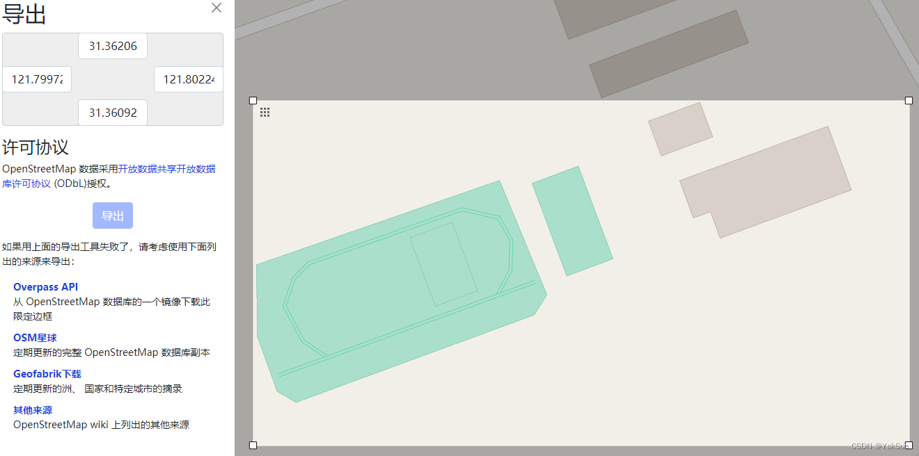
这里就出现了多个way节点,并且根据tag可以区分出各自的种类:
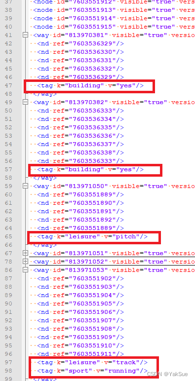
比如这里不仅有建筑,还有操场,和跑道。
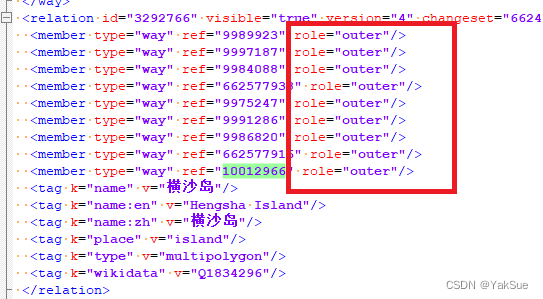
例3:relation的一个例子
这是横沙岛的一个边界。可以在文件中找到一个relation节点,它指明了自己的边界包含了哪些way节点:
总结
结合这些简单的例子,以及Wiki的介绍,我学到关于OSM文件的一些最基础的结构:
- 每个
node节点代表空间中的一个位置,具有经纬度属性。 way节点引用了node,以有序列表的方式定义了一个范围。relation节点(关系)引用了way节点(wiki指出还可能引用node或其他relation)作为成员(member),并且指出了每个成员在这个关系中所扮演的角色。- 每个节点都可能包含
tag属性,来附带上额外的信息。
附录:Wiki上关于OSM格式的介绍
Wiki地址:https://en.wikipedia.org/wiki/OpenStreetMap
OpenStreetMap uses a topological data structure, with four core elements (also known as data primitives):
- Nodes are points with a geographic position, stored as coordinates (pairs of a latitude and a longitude) according to WGS 84.[106] Outside of their usage in ways, they are used to represent map features without a size, such as points of interest or mountain peaks.
- Ways are ordered lists of nodes, representing a polyline, or possibly a polygon if they form a closed loop. They are used both for representing linear features such as streets and rivers, and areas, like forests, parks, parking areas and lakes.
- Relations are ordered lists of nodes, ways and relations (together called "members"), where each member can optionally have a "role" (a string). Relations are used for representing the relationship of existing nodes and ways. Examples include turn restrictions on roads, routes that span several existing ways (for instance, a long-distance motorway), and areas with holes.
- Tags are key-value pairs (both arbitrary strings). They are used to store metadata about the map objects (such as their type, their name and their physical properties). Tags are not free-standing, but are always attached to an object: to a node, a way or a relation. A recommended ontology of map features (the meaning of tags) is maintained on a wiki. New tagging schemes can always be proposed by a popular vote of a written proposal in OpenStreetMap wiki, however, there is no requirement to follow this process. There are over 89 million different kinds of tags in use as of June 2017.[107]