shp数据入库、出库、可视化
今天给npy写了次作业,由于各种原因,不能用我用了很久的SSM或者SpringBoot框架,只用了最原始的servlet+jsp,然后我发现…自己已经不太会用了,写这个博客记录一下整套流程~
首先,作业的大致要求是将几何数据导入数据库,然后进行查询,使用地图可视化库进行可视化。因此,本次作业决定使用中国地图shp数据,导入PostgreSQL数据库,接着查询数据,最后使用Openlayers对查询到的数据进行可视化。
技术选型
PostgreSQL + Servlet + jsp + Openlayers
一 shp数据入库
首先使用命令行将shp数据转化为sql语句:
shp2pgsql "shp路径" "数据库名"> "sql路径"
如:
shp2pgsql F:/BoundaryChn2_4p.shp boundary> F:/boundary.sql
然后在pgadmin中执行该sql文件即可。
二 搭建servlet程序
本次使用maven搭建web程序,文件结构如下:

pom.xml:
<?xml version="1.0" encoding="UTF-8"?>
<project xmlns="http://maven.apache.org/POM/4.0.0"xmlns:xsi="http://www.w3.org/2001/XMLSchema-instance"xsi:schemaLocation="http://maven.apache.org/POM/4.0.0 http://maven.apache.org/xsd/maven-4.0.0.xsd"><modelVersion>4.0.0</modelVersion><groupId>com.tm</groupId><artifactId>webgis</artifactId><version>1.0-SNAPSHOT</version><packaging>war</packaging><dependencies><dependency><groupId>junit</groupId><artifactId>junit</artifactId><version>4.13</version><scope>test</scope></dependency><dependency><groupId>org.postgresql</groupId><artifactId>postgresql</artifactId><version>42.2.12</version></dependency><dependency><groupId>javax.servlet</groupId><artifactId>javax.servlet-api</artifactId><version>4.0.1</version><scope>provided</scope></dependency><dependency><groupId>jstl</groupId><artifactId>jstl</artifactId><version>1.2</version></dependency><!--Tomcat引用--><dependency><groupId>org.apache.tomcat.embed</groupId><artifactId>tomcat-embed-core</artifactId><version>[9.0.20,)</version><scope>provided</scope></dependency></dependencies><build><finalName>MWebgis</finalName><plugins><plugin><groupId>org.apache.maven.plugins</groupId><artifactId>maven-compiler-plugin</artifactId><configuration><source>7</source><target>7</target></configuration></plugin></plugins><resources><resource><directory>src/main/java</directory><includes><include>**/*.properties</include><include>**/*.xml</include></includes><filtering>true</filtering></resource><resource><directory>src/main/resources</directory><includes><include>**/*.properties</include><include>**/*.xml</include></includes><filtering>true</filtering></resource></resources></build>
</project>
不赘述,文末有github链接,可自行查看。
三 数据库查询
1 数据库配置:
useSSL=false
verifyServerCertificate=false
url=jdbc:postgresql://ip:port/database
driver=org.postgresql.Driver
user=**** # 改成自己的
password=**** # 改成自己的
2 数据库链接类:
public class DBHelper {static String url;static Properties pro = new Properties();static{InputStream in = DBHelper.class.getClassLoader().getResourceAsStream("config.properties");try {pro.load(in);url = pro.getProperty("url");String driver = pro.getProperty("driver");Class.forName(driver);System.out.println("驱动器加载成功");} catch (IOException e) {System.out.println("驱动器加载失败");} catch (ClassNotFoundException e) {System.out.println("驱动器加载失败");}}public static Connection getConnection() throws SQLException{//创建数据库连接Connection con = DriverManager.getConnection(url, pro);return con;}
}
3 数据库查询方法,返回为geojson:
public String getBoundaryChn2PShp() {String result ="";String sql = "SELECT row_to_json(fc) FROM ( SELECT 'FeatureCollection' As type,array_to_json(array_agg(f)) As features FROM (SELECT 'Feature' As type, ST_AsGeoJSON(lg.geom)::json As geometry ,gid As properties FROM boundarychn2_4p As lg ) As f ) As fc";try (Connection conn = DBHelper.getConnection();PreparedStatement pstmt = conn.prepareStatement(sql);ResultSet rs = pstmt.executeQuery();) {if (rs.next()) {result = rs.getString(1);}} catch (SQLException e) {// TODO Auto-generated catch blocke.printStackTrace();}return result;}
四 Openlayers数据可视化
1 index.js
var image = new ol.style.Circle({radius: 5,fill: null,stroke: new ol.style.Stroke({color: 'red', width: 1})
});var styles = {'Point': new ol.style.Style({image: image}),'LineString': new ol.style.Style({stroke: new ol.style.Stroke({color: 'green',width: 1})}),'MultiLineString': new ol.style.Style({stroke: new ol.style.Stroke({color: 'green',width: 1})}),'MultiPoint': new ol.style.Style({image: image}),'MultiPolygon': new ol.style.Style({stroke: new ol.style.Stroke({color: 'yellow',width: 1}),fill: new ol.style.Fill({color: 'rgba(255, 255, 0, 0.1)'})}),'Polygon': new ol.style.Style({stroke: new ol.style.Stroke({color: 'blue',lineDash: [4],width: 3}),fill: new ol.style.Fill({color: 'rgba(0, 0, 255, 0.1)'})}),'GeometryCollection': new ol.style.Style({stroke: new ol.style.Stroke({color: 'magenta',width: 2}),fill: new ol.style.Fill({color: 'magenta'}),image: new ol.style.Circle({radius: 10,fill: null,stroke: new ol.style.Stroke({color: 'magenta'})})}),'Circle': new ol.style.Style({stroke: new ol.style.Stroke({color: 'red',width: 2}),fill: new ol.style.Fill({color: 'rgba(255,0,0,0.2)'})})
};var styleFunction = function(feature) {return styles[feature.getGeometry().getType()];
};var geojsonObject = {};
$.ajax({type : 'post', //传输类型async : false, //同步执行url : 'shp', //web.xml中注册的Servlet的url-patterndataType : 'json', //返回数据形式为jsonsuccess : function(result) {geojsonObject = resultvar vectorSource = new ol.source.Vector({features: (new ol.format.GeoJSON()).readFeatures(geojsonObject,{featureProjection: 'EPSG:3857'})});var vectorLayer = new ol.layer.Vector({source: vectorSource,style: styleFunction});var map = new ol.Map({layers: [new ol.layer.Tile({source: new ol.source.OSM()}),vectorLayer],target: 'map',view: new ol.View({center: [116, 39],zoom: 4})});},error : function(errorMsg) {alert("加载数据失败");}
});
2 index.jsp
<%@ page contentType="text/html;charset=UTF-8" language="java" %>
<%@taglib prefix="c" uri="http://java.sun.com/jsp/jstl/core" %>
<html>
<c:set var="path" value="${pageContext.request.contextPath }"/>
<head><title>index</title><script>var path = "${path}";</script><style>*{margin: 0;padding: 0;}.map {width: 100vw;height: 100vh;}</style>
</head>
<body>
<div id="map" class="map"></div>
<script src="${path}/lib/jquery-3.4.1.js"></script>
<script src="${path}/ol/ol.js"></script>
<link rel="stylesheet" href="${path}/ol/ol.css">
<script src="${path}/js/index.js"></script>
</body>
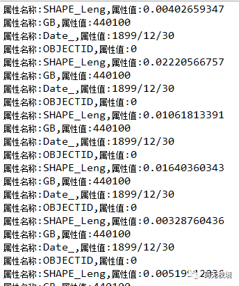
</html>五 效果

六 github
github